
Explore Your Watershed:
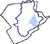
The Lower Brodhead Subwatershed
Drainage Area: 28.2 square miles
Brodhead Watershed, Monroe County, PA
MUNICIPALITIES IN THE WATERSHED
East Stroudsburg Borough
Stroudsburg Borough
Price Township
Stroud Township
Smithfield Township
Middle Smithfield Township
NAMED STREAMS
Cranberry Run
Michael Creek
Sambo Creek
Little Sambo Creek
Marshalls Creek
McMichael Creek
NAMED LAKES, PONDS, AND IMPOUNDMENTS
Hallowood Lake (on Long Run)
Woodland Lake (on Michael Creek)
Analomink Lake (on trib to Brodhead Creek)
Pocohontas Dam (on trib to Brodhead Creek)
Blue Mountain Lake (on trib to Brodhead Creek)
Pinebrook Lake (on trib to Brodhead Creek)
Spring Lake (on trib to Brodhead Creek)
Gregory Pond (on Zacharias Run)
East Stroudsburg Upper Reservoir (on Sambo Creek)
East Stroudsburg Middle Reservoir (on Sambo Cfreek)
East Stroudsburg Lower Reservoir (on Sambo Creek)
Eagle Lake (on unnamed trib to Sambo Cfreek)
Mountain Vista Campgrounds Lake (on unnamed trib to Sambo Creek)
Lake Valhalla (on Little Sambo Creek)
Zacharias Pond (in East Stroudsburg)
Do you know?
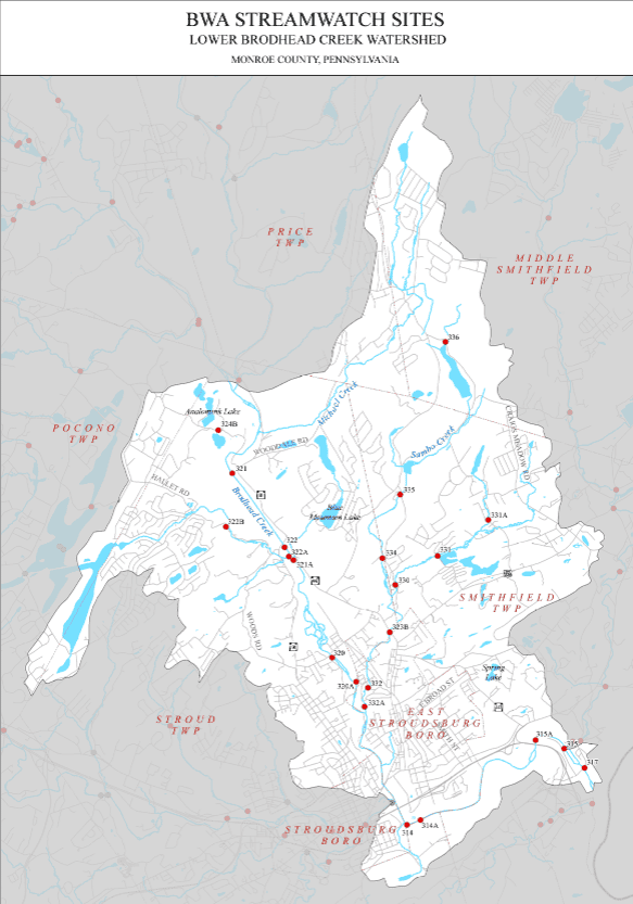
The Lower Brodhead subwatershed includes the Brodhead Creek and its tributaries below the Brodhead’s confluence with Paradise Creek, at Routes 191 and 447. The Lower Brodhead flows for 6.5 miles through Price, Smithfield and Stroud townships, then forms the boundary between Stroudsburg and East Stroudsburg Boroughs for another 5.5 miles before joining the Delaware River, draining a total of 28.2 square miles. After the flood of 1955, the Brodhead was channelized from below Analomink thru the boroughs of Stroudsburg and East Stroudsburg and levees were built through the boroughs. Intense commercial and residential development occurs along and near the stream in the mid and southerly sections of the subwatershed. Major tributaries include Cranberry Run, Michael Creek, Sambo Creek and McMichael Creek.
DRINKING WATER
The Lower Brodhead and Sambo Creek are important sources of drinking water for the boroughs of Stroudsburg and East Stroudsburg. Three reservoirs for East Stroudsburg’s drinking water supply are found on Sambo Creek.
The BRODHEAD CREEK REGIONAL AUTHORITY draws fifty percent of its water from the Brodhead Creek and the balance from wells near the Creek. BCRA has permits to withdraw 5.38 million gallons per day (mg/d) from the Brodhead Creek and nearby wells. In 1999, the average daily use was approximately 1.9 mg/d or about 35 percent of its total permitted capacity. Of the permitted 5.38 mg/d, approximately 2.5 mg/d is withdrawn directly from the Brodhead Creek and approximately 2.88 mg/d is drawn from the nearby wells. On an annual basis, approximately 8-12 million gallons are exported from the watershed to be used for bottled water. BCRA provides water to Stroudsburg and parts of Hamilton, Paradise, Pocono Smithfield and Tobyhanna Township.
BCRA sponsors a Source Water Protection program to protect water quality in the Brodhead watershed. Visit WWW.DRWATERS.ORG to learn more.
WASTEWATER DISCHARGES
The East Stroudsburg borough, Rock Tenn, Inc, and Manwalamink (Shawnee) sewage treatment plants discharge to the Brodhead. Blue Mountain Lake Development and Smithfield township sewage treatment plants discharge in the Sambo Creek subwatershed. Penn Estates Development discharges to Cranberry Run, which enters the Brodhead near Pinebrook Camp, and Bible Fellowship Camp sewage treatment plant discharges to the Brodhead in this section.