
Explore Your Watershed:
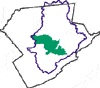
The Pocono Creek Subwatershed
Drainage Area: 46.5 square miles
Brodhead Watershed, Monroe County, PA
MUNICIPALITIES IN THE WATERSHED
Pocono Township
Jackson Township
Stroud Township
Stroudsburg Borough
Tobyhanna Township
Tunkhannock Township
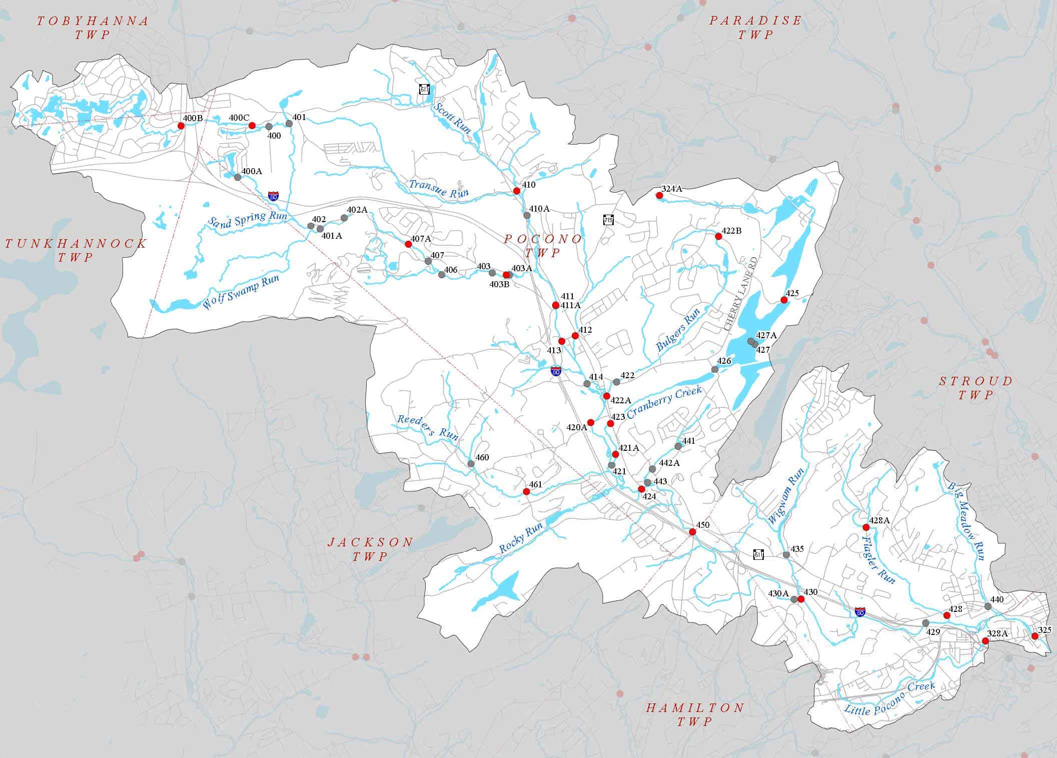
NAMED STREAMS
Pocono Creek
Little Pocono Creek
Big Meadow Run
Flagler Run
Wigwam Run
Rocky Run
Reeders Run
Coolmoor Creek
Cranberry Creek
Bulgers Run
Scot Run
Transue Run
Wolf Swamp Run
Sand Spring Run
Dry Sawmill Run
NAMED LAKES, PONDS, AND IMPOUNDMENTS
Wolf Swamp Run Dam (on Wolf Swamp Run)
Pine Tree Lake (on Dry Sawmill Run)
Emerald Lakes/Youngs Pond (on Dry Sawmill Run)
Crescent Lake (on Dry Sawmill Run)
Mountaintop Lake (on Dry Sawmill Run)
Wilson Dam (on Dry Sawmill Run)
Deer Pond (on Dry Sawmill Run)
Little Deer Pond (on Dry Sawmill Run)
Deep Lake (on Sand Spring Run)
Lindemere Dam (on Pocono Creek)
Barneys Pond (on Pocono Creek)
Camelback Reservoir (on Pocono Creek)
Shaeff & Peters Dam (on Pocono Creek)
Brookdale Lake (on Scot Run)
Leisure Lake (on Scot Run)
Massad Camp Dam (on Scot Run)
Noah’s Ark Dam (on Scot Run)
Hemlock Lake (on Cranberry Creek)
Hunter Lake (on Rocky Run)
Lenape Lake (on Rocky Run)
Wigwam Lake (on Wigwam Run)
Flagler Dam (on Flagler Run)
Lower Dam (on Flagler Run)
Laurel Lake (on Laurel Run)
Twin Hills Dam (on Little Pocono Creek)
Do you know?
The Pocono Creek drains the Pocono Plateau in its headwaters in Tobyhanna and Tunkhannock Townships and flows for 16 miles in a southeastern direction through Pocono, Jackson, Hamilton and Stroud Townships where it converges with the McMichael Creek in Stroudsburg. The Pocono watershed drains a surface area of approximately 48 square miles and contains 14 sub-basins within its boundaries. The Pocono Creek is paralleled by Interstate-80 and the county’s primary commercial artery, Route 611, which was built in the floodplain. Intense commercial development occurs along and near the stream in the middle and southerly sections of the watershed.
The Pocono Plateau escarpment forms the watershed’s most prominent topographic feature, Big Pocono Mountain, which forms the western watershed boundary. The watershed includes the Tannersville Cranberry (peat) Bog, which is believed to have formed during a glacial retreat. The Cranberry Bog is the southernmost alpine boreal bog in the United States and is found in the east-central portion of the watershed. A large portion of the bog is protected through ownership and management by the Nature Conservancy. The Bog forms the eastern edge of the watershed.
The major tributaries running south into the Pocono Creek are Dry Sawmill Run, Sand Spring Run, Wolf Swamp Run in the north and Scot Run, Transue Run, Bisbing Run, Bulger’s Run, and Cranberry Creek in the mid-section. Those running north into the Pocono Creek’s mid-section are Colmoor Creek and Reeders Run. Wigwam Run, Flagler Run, Big Meadow and Little Pocono are within the lower third of the watershed. Sand Spring Run and Wolf Swamp Run are designated Exceptional Value.
A number of sewage treatment plants discharge into the Pocono and its tributaries, including: Caesars Brookdale, discharges to Brookdale Lake; Crossings Outlet Mall, Camelback Ski Resort, Big Pocono Utilities, and Pocono Auto-Truck Stop discharge to the Pocono; PennDot rest-stop on Rte 80, Fountain Court and Fountain Court West discharge to tributaries; Barton Court Trailer Park and Monroe County Careet and Technical Institute discharge to Laurel Lake Run; Birchwood Resort discharges to the Cranberry Bog.
Evidence indicates that the Pocono Creek watershed is a high-quality resource on the edge of decline, and that same evidence may reveal the thresholds at which impairment occurs. Many negative impacts have been observed in localized areas. The natural resilience of the watershed is currently taxed by development, transportation, and maintenance practices. Storm water runoff from parking lots and roads causes habitat damage and numerous localized stream modifications such as roads, bridges, culverts, channelized areas, floodplain development, and riparian vegetation removal degrade the watershed’s streams as well.
Big Pocono Mountain (Camelback) forms the watershed divide between the McMichael and the Pocono watersheds. Camelback ski area, on the north face of the mountain, drains to the Pocono Creek.