
Explore Your Watershed:
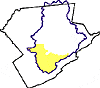
The McMichael Creek Subwatershed
Drainage Area: 69.5 square miles
Brodhead Watershed, Monroe County, PA
MUNICIPALITIES IN THE WATERSHED
Jackson Township
Hamilton Township
Chesnuthill Township
Stroud Township
Stroudsburg Borough
Ross Township
Tunkhannock Township
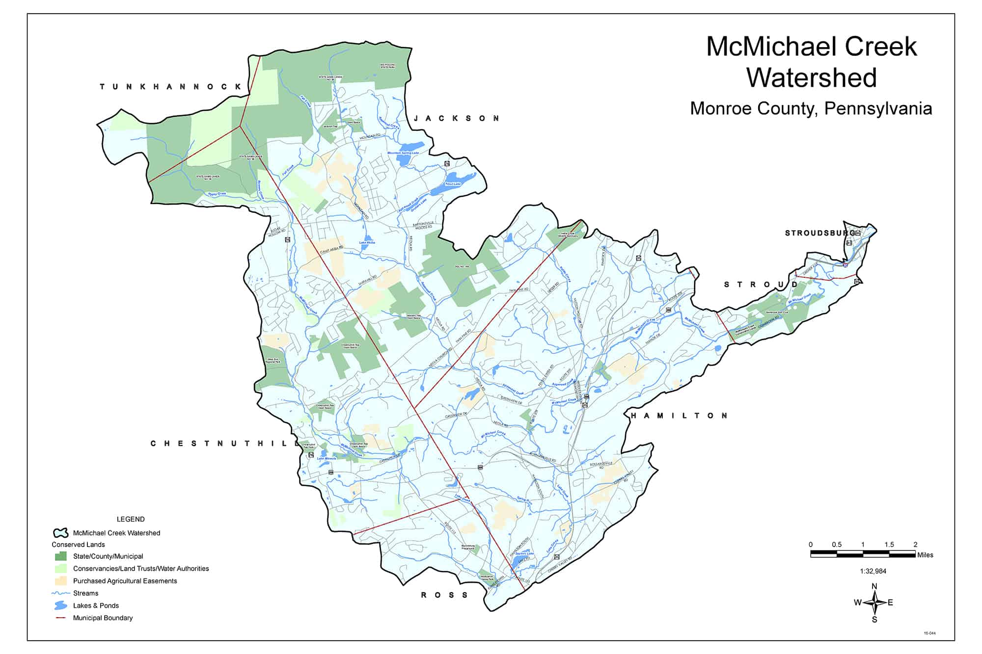
NAMED STREAMS
Appenzell Creek
Bowers Creek
Fall Creek
Hypsy Creek
Kettle Creek
Lake Creek
Spring Run
NAMED LAKES, PONDS, AND IMPOUNDMENTS
Camp Akiba Lake
Gruber’s Lake
Lake Mineola
Meadow Lake
Mountain Springs Lake
Stone Inn Lake
Trout Lake
Saylors Lake
Do you know?
The McMichael Creek forms at the confluence of three headwater tributaries: Hypsy, Bowers, and Fall Creeks, which arise from wetlands and springs on the Pocono Plateau in Tunkhannock and Jackson Townships. The headwaters area of these creeks is relatively steep terrain forested primarily with second-growth hardwoods and a streamside canopy of rhododendron.
The McMichael Creek flows in a southerly, then northeasterly direction before converging with the Brodhead Creek in Stroudsburg. The McMichael Creek flows approximately 19 miles with a vertical drop of 1700 feet and drains an area of 69.5 square miles. Headwaters streams begin at elevations ranging from 2100 feet at the top of Big Pocono Mountain to 1800 feet at Hypsy gap; the McMichael Creek enters the Brodhead at an elevation of about 400 feet. The main channel separates at two locations: one mile below the town of McMichaels and again one mile above Brodheadsville, forming two distinct “splits” which rejoin downstream.
A significant portion of the McMichael Creek subwatershed is designated Exceptional Value, including Fall Creek, Bowers Creek, Hypsy Creek, and the upper part of the McMichael Creek.
The regional sewage treatment plant, operated by the Brodhead Creek Regional Authority, discharges to the McMichael Creek near its confluence with the Brodhead. The plant serves Stroudsburg, and parts of Hamilton, Pocono, Paradise and Tobyhanna Township. Plants at Snydersville Diner and Monroe County Jail/Pleasant Valley Manor discharge to the McMichael or tributaries in the Snydersville area.
Lake Creek flows from Saylors Lake, joining the McMichael near Sciota. Formerly known as Lake Poponoming, Saylors Lake is the most southern moraine lake in the State. “It lies absolutely on the top of the moraine, and its surroundings are especially interesting from the fact that large boulders have been found on its shores which originally came from a point not nearer than the Adirondack region, 250 miles away, and which must have been transported by the slow moving ice masses of the ice age.” (Report of the State Commissioner of Fisheries, 1896, p. 234) The lake is fed by strong bubbling springs in the bottom of the lake.
The Northern Bullrush, a globally rare plant, is found at Lake Mineola in the McMichael watershed.
The Kettles, located on an unnamed tributary to Kettle Creek, are deep, circular depressions in bedrock created by the melting of large blocks of stagnant ice left behind by the glaciers.
Big Pocono Mountain (Camelback) forms the northeastern boundary of the McMichael watershed.