
WATERFALL PHOTOGRAPHY
Ancient gift of the glacier captured in waterfall photos
By Carol Hillestad
Editor’s note: “Woods & Water” is an occasional feature focusing on the relation between land and water quality – and the conservation easements that help preserve our environment in the Brodhead watershed.
By Carol Hillestad
For Brodhead Watershed Association
For more than 64,000 years, up until just 11,000 years ago, a glacier covered much of the northern world. A massive part of it, the Laurentide Ice Sheet, shrouded millions of square miles of what we call North America.
From the far north of Canada, down through all New England, then New York and Pennsylvania to Missouri, and along a ragged edge enclosing the plains and upper American West — all that land was mantled in ice.
Ice that was two miles thick!
Weighty beyond imagining, the ice flowed, advanced, and receded, carving and shaping the land as it moved. It plucked up and carried boulders the size of houses, dropping them hundreds of miles away. It dragged stones trapped underneath it, which incised deep grooves— striations still clearly seen in New York City’s Central Park, the village of Delaware Water Gap, and far and wide in the glacial shadow.
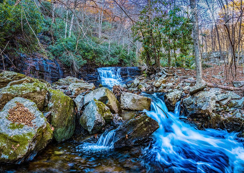
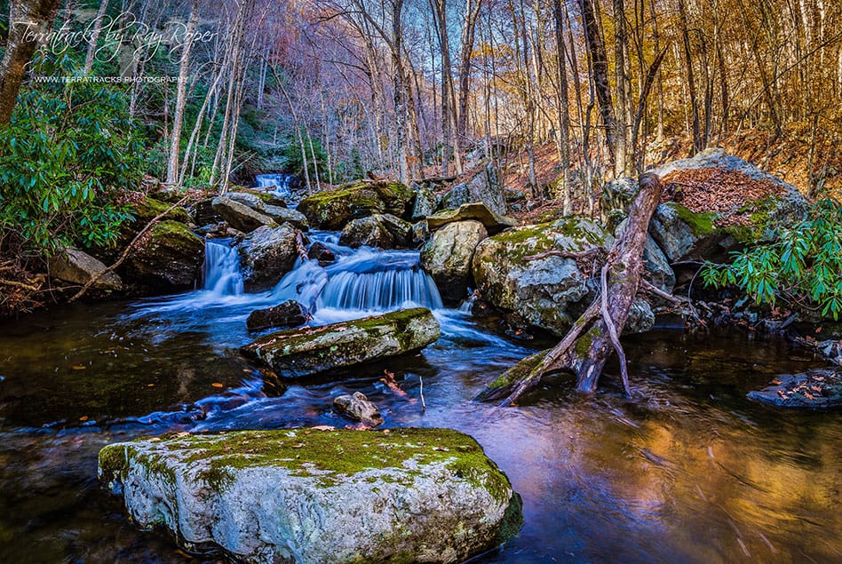
As it melted and receded, the ice sheet shaped the terrain we see today on the Pocono Plateau.
Gravel, stones, boulders, sand and mud were tumbled and ground beneath the glacier and remained behind in its wake. These broad, deep drifts of “glacial till” are porous, and created huge reserves for containing ground water in the landscape. Enormous basins scoured by the glacier filled over time with the swamps, peat bogs, and wetlands we see today on the plateau. The low undulations are now cloaked in rhodora, blueberries, and north-loving trees like red spruce and tamarack.
Out of the water held here, rivulets form and drain toward the margins of the plateau. At the folds of the eroded edge, the water is freed, in springs, seeps and headwaters creeks — and waterfalls. This is where our most dramatic waterfalls begin.
By some counts, Pennsylvania has 75 named waterfalls. Thirty of those are in the Poconos, gifts from the glacier.
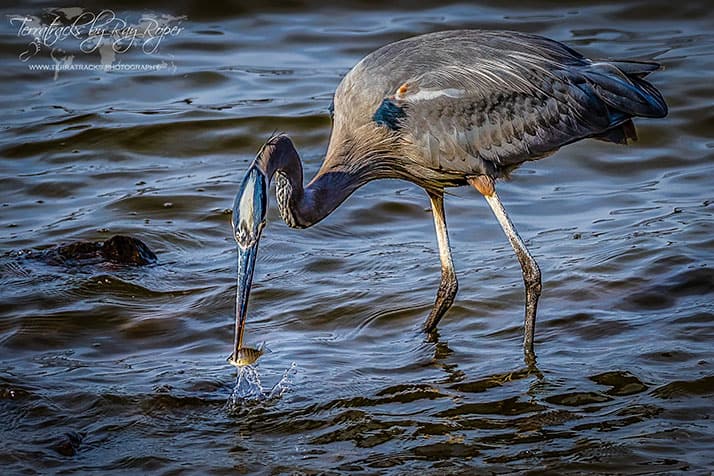
Many are privately owned. Some, like Devil’s Hole, Rattlesnake Falls, Caledonia Falls, and Marshall Falls, are on public lands. But waterfalls are a magnet for people, and one person in particular has photographed dozens of waterfalls, waterways, and wetlands throughout the Brodhead watershed.
Adventurer, former pilot, and Colorado native Ray Roper has been making photos for decades. “Water in all its forms is endlessly fascinating,” he said. “Frozen, flowing, cascading, even as crystals in the air – it always rewards the careful observer.”