
Where: From Tannersville, Pa., take Route 715 South past Jackson Township Fire Co. and Municipal Building, to the four corners stop. Go left on Neola Road. Take Neola Road 2.2 miles to Sherwood Forest Road. Go right. The parking area is half a mile on the left.
GPS coordinates:
Trailhead: 40.968270, -75.355488
Trail information: Trails are rough-flagged, and may be wet and rocky. Wear sturdy footwear, take water, and make sure someone knows where you are and when you will return.

In 2007, when Jackson Township, Pa., supervisors acquired 175 acres of land along both sides of Sherwood Forest Road, they had a plan. The idea was to create connections with neighboring natural areas and provide recreation for residents and visitors, while conserving and showcasing the township’s natural beauty and agricultural heritage.
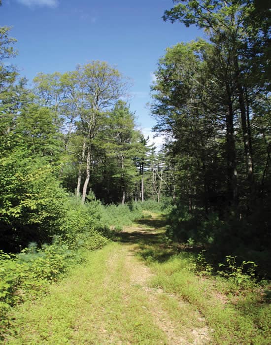
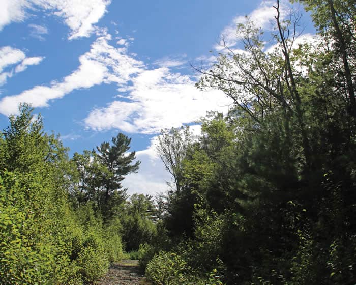
Rough roads already crisscrossed the property, and even today, some are still quite open. But Mother Nature has started to reclaim her own. Young white pines, beech saplings, and goldenrod have put down roots in road cuts bedded with gravel and shale. Other roads are there, but hard to find and barely passable.
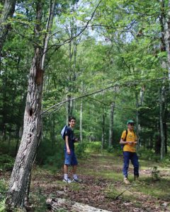 For Saylorsburg residents Ambrose Cavalier and his father, Forrest, pictured at right, the idea of scoping out a trail network, by linking existing roads at the preserve, presented a challenge they couldn’t pass up.
Using satellite images, Google Maps, GPS, and other mapping tools, Ambrose created a map of the property. On a perfect, sky-blue day in August, wildlife photographer Nancy Hopping and I met Ambrose and his dad at the preserve to test the map.
The parking area curves off Sherwood Forest Road and once provided access to a barn, remains of which can still be seen. A short walk east along the road brings us to the trailhead, marked by a chain. We scramble along the edge of an overgrown field, crossing the almost-dry bed of a small tributary of Appenzell Creek. The Appenzell runs to McMichael Creek, a high-quality trout stream that, in turn, pours into the Delaware River, headed for the Atlantic Ocean. Keeping this land in its natural state protects drinking water for locals and everyone downstream.
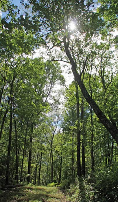
It also provides a delightful walk. The four of us reach the welcome shade of the woods — mostly beech, with oaks, maple, and some white pine and hemlocks, too. If the barn’s remains and field weren’t enough, we find more evidence that this was once a farm: Four-strand barbed-wire fencing is embedded in trees along a sturdy stone row.
On the other side of the stone row, the woods are open, and deer tracks are everywhere. Hay-scented ferns and club mosses grow here, but the deer have eliminated the blueberries, tender tree seedlings, and even invasives such as barberry we would expect to see.
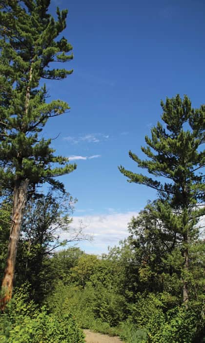
Following the route Ambrose has mapped out, we head south and east. It’s an easy, uphill slope at first, gradually increasing as we loop upward toward the summit. At this higher elevation, we see lots of chestnut oaks, many bearing egg masses of gypsy moths. The mating calls of male cicadas, those boisterous bugs of summer, seem to be everywhere.
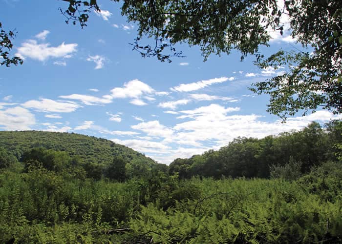
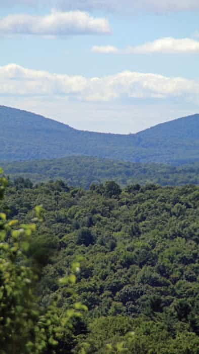
Through a leafy, dark green tunnel of arching beech saplings — hundreds of them, no more than a thumb’s thickness — Ambrose leads us out into the full sun again. It’s a short stretch up a wide road to the view. From our perch at 1,125 feet, we see Delaware Water Gap to the left, Wind Gap to the right, and a glimpse of Palmerton Gap, as well. Behind us are long vistas of Camelback and state gamelands.
You get a top-of-the-world feeling here — clouds scud by at eye level, the shadow of a hawk passes, and the silence is complete.
Thanks go to the voters of Jackson Township and Monroe County for setting aside funds to purchase awesome natural places like this — and to Ambrose and his dad for taking the initiative and mapping a way through this beautiful preserve in Jackson Township!
Carol Hillestad is a hike leader and writer for Get Outdoors Poconos, a grant-funded series administered by Brodhead Watershed Association.