
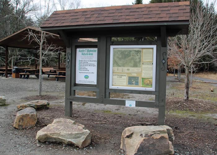
Where: Near Blakeslee, Pa. Take Route 80 to Exit 284 – Route 115 North. After the Tobyhanna Creek bridge, parking areas are on left. Note: Two trailheads serve Austin T. Blakeslee Natural Area.
GPS coordinates 41º 4’ 59”N 75º 35’ 4” W, elevation 1,560 feet.
Trail information: Trails are blazed in red, blue and orange. Many side trails exist. Roots and rocks are common on the trails, which are wet in many places. Sturdy, appropriate footwear is essential. A walking stick is helpful.
![]()
![]()

For more than 80 years, long before it became the Austin T. Blakeslee Natural Area, this land along Tobyhanna Creek was a communal pleasure ground. Starting in the 1930s, when it was Harrison Park and later Toby Park, it boasted a roller rink, dance hall, swimming pools, steam-operated carousel, penny arcade, and softball fields.
Then the Flood of ’55 swept it all away.
Today, what remains of the original buildings are low walls and memories. But this 130-acre preserve is still a center of community life — just off Route 115 and close to Blakeslee and Route 80, it is an easy-to-reach haven for walking, fishing, picnicking, photography, and peaceful contemplation.
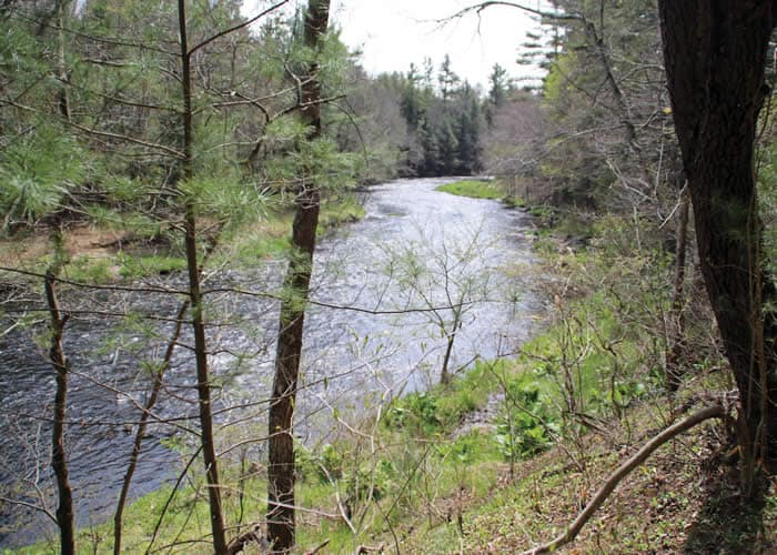
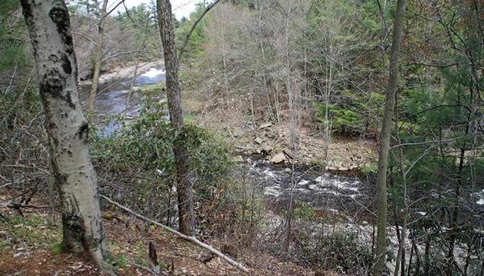
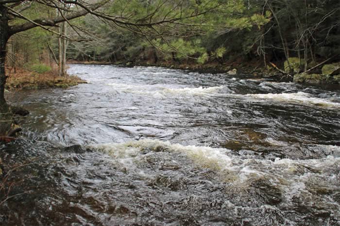
 Well-worn paths take you right to the brink of the creek, where you are likely to find people fishing, spring through fall. If, like me, you are familiar with the rushing creeks in the Brodhead watershed that cascade off the Pocono Plateau and flow quickly to the Delaware, the Tobyhanna is a change of pace. With headwaters above Tobyhanna Lake, and flowing more slowly for 30 miles across the Plateau, the Tobyhanna is a wide, almost stately, creek.
From several points along the trail, you can clearly see its meandering path as it journeys toward the Lehigh River, then through the Lehigh Valley, not reaching the Delaware until Easton. Protecting this water safeguards drinking water for millions of people downstream.
Three blazed trails make for lots of hiking options. There’s a quick half-mile loop – Pine Trail – blazed in orange. Highland Trail, blazed in blue, is almost a mile long and loops through mixed hardwood and pine forest above the creek.
But it’s the red-blazed Creek Trail – a 2.3-mile, out-and-back walk along the creek – that I have in mind.
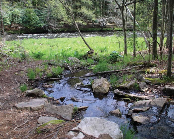
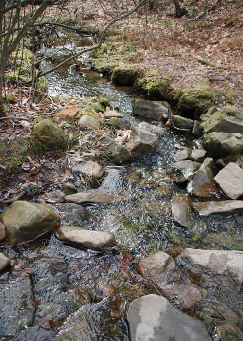
A male red-winged blackbird calls from the cattails in a small wetland even before I get into the grove of red pines at the start of the trail. Seeps and wetlands on the uphill side are crowded with drifts of lush green skunk cabbage. Small, unnamed tributaries also cross the trail in places. The walking would be mucky, but volunteers have placed bridges and simple stepping-stone crossings made of tree-trunk slices and smooth rocks where they are needed.
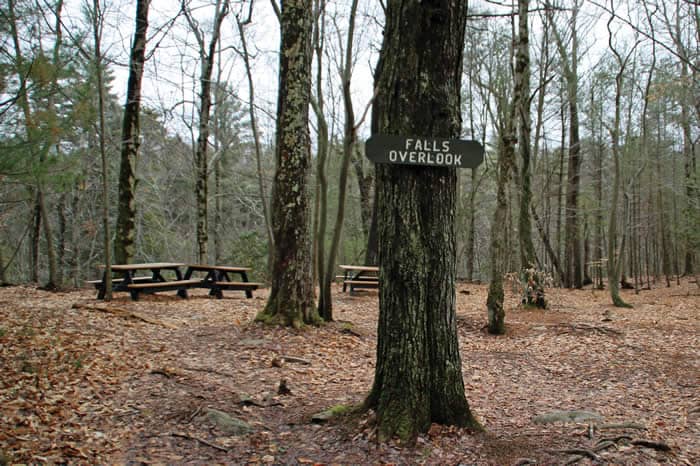
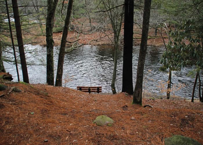
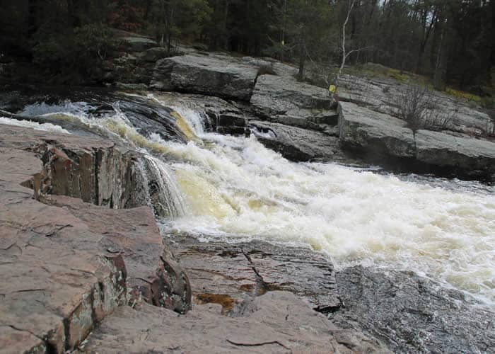
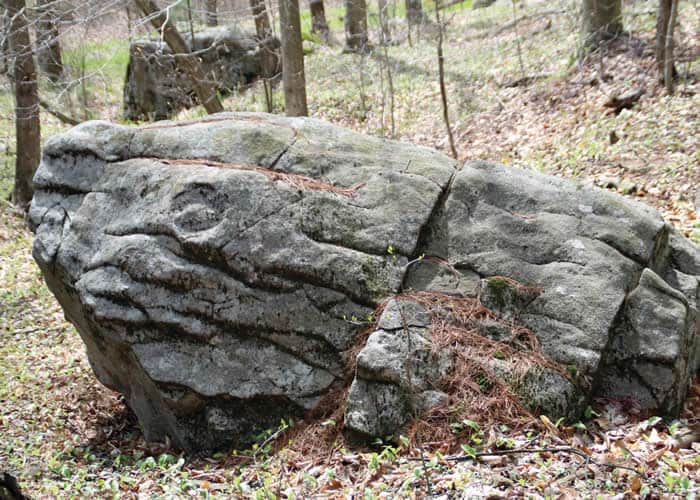
There are lots of blueberry bushes and glacier-dropped boulders along the way to the highlight that everyone aims for — the falls. Wide, flat bedrock above the falls has been worn smooth by decades of sightseers and fishermen. With good balance and a walking stick, you can make your way down to the deep pools below the falls and along the very edge of the creek, with no sound but the rushing water in your ears. Or take the easier high route to an overlook above, in a clearing furnished with picnic tables and benches.
The trail continues another half-mile, with postcard-worthy views of the creek all along the way — just over a mile of prime creek frontage. At the boundary of the conserved land, a small white sign reminds me that this property has been preserved by the people of Tobyhanna and Tunkhannock townships and Monroe County for the use and pleasure of all. I’ve reached the end of the trail, but still have the pleasure of walking back.
Austin T. Blakeslee Natural Area is among the best loved and most used public spaces in the county. Appropriately, it is named for a beloved member of the community — farmer, conservationist, and “a really good guy.” At times within earshot of Route 80, the preserve is still a source of peace, beauty and wonder, enjoyed by generations past and preserved for generations to come.
Carol Hillestad is a hike leader and writer for Get Outdoors Poconos, a grant-funded series administered by Brodhead Watershed Association.