Wolf Rocks

IF YOU GO
Where: Trailhead near Bangor, Pa., with limited parking.
Take Route 191 south through Stroudsburg. Route 191 becomes Bangor Mountain Road and then Valley View Drive. Trailhead is on Valley View Drive, Bangor, at the top of the mountain, just south of Kirkridge retreat center.
Trail information: 3.5-mile out-and-back moderate hike with one rocky scramble on the Appalachian Trail.
KNOW BEFORE YOU GO:
- Trailhead parking is extremely limited.
- No restrooms or trash cans. Pack out what you pack in.
- Boots required. Hiking stick suggested.
- This section of the Appalachian Trail is maintained by the Batona Hiking Club.

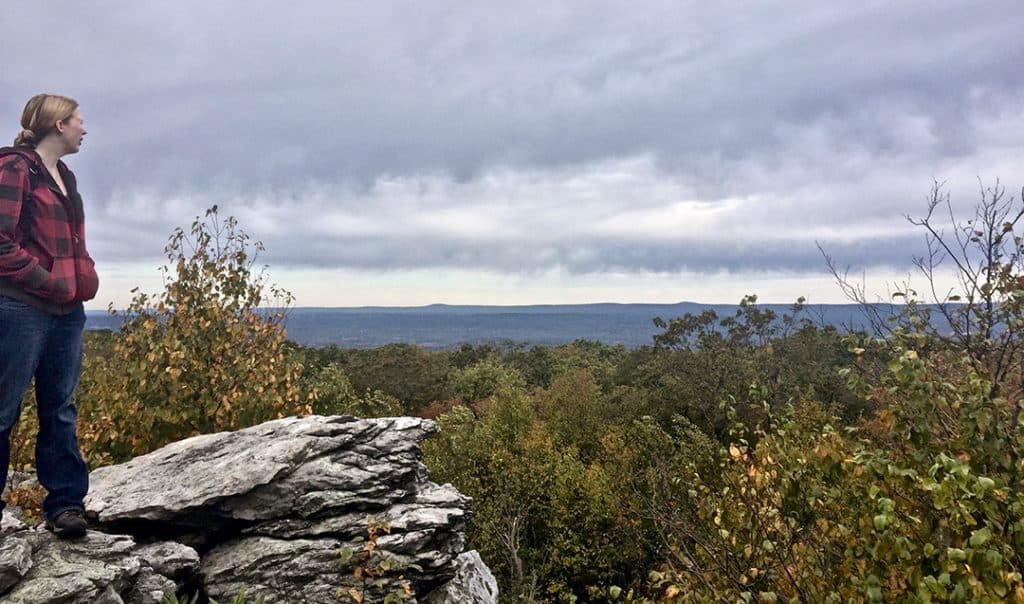
Sarah Corcoran of the Sierra Club delights in the view from Wolf Rocks.

Finding Wolf Rocks on the Appalachian Trail
By Carol Hillestad
My hiking companion, Sarah Corcoran, seems to be standing on top of the world. The massive boulder beneath her feet juts out over treetops far below, when suddenly, OMG, she’s moving into a yoga pose, balancing on one leg, arms reaching up like tree limbs, silhouetted against a cloudy October sky.
I hold my breath, palms sweating, until she slowly unwinds — and we both laugh with pure joy at being part of this amazing place.
Sarah is Sierra Club’s Forest Watch coordinator for our area, and she spends a lot of time leading hikes throughout the Poconos. Yet neither of us had ever hiked to Wolf Rocks before.
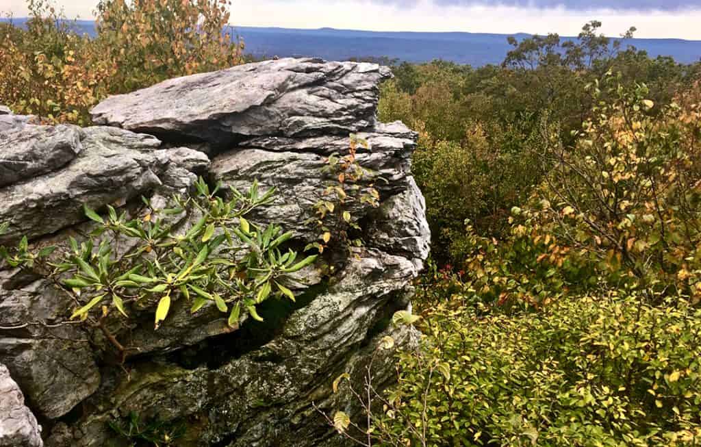
For through-hikers on the Appalachian Trail, Wolf Rocks is one of the compensations for miles of ankle-busting trails through “Rocksylvania.” The 180-degree view takes in Poplar Valley and Godfrey’s Ridge in the distance. Even on a lowering, misty day, a view like this makes you breathe a little deeper, stand a little taller, and feel renewed in an almost primeval way.
And, not knowing what to expect, we’d almost missed it!
We’d set off from the trailhead about an hour ago, walking through pleasant fall woods. Like elsewhere along the AT, the trail was well marked and well maintained, thanks to volunteers from a local hiking club. The air was fragrant with the scent of fallen leaves. Autumn-yellow, hay-scented ferns lined the trail. We saw woolly-bear caterpillars, a toad, and the grey-and-brown papery remains of a wasp nest. The trail was uphill in places, and rocky, though not especially so.
Through the trees, the sky seemed to brighten. Then we were facing a wall of tumbled boulders, covered with mosses, crustose lichens and rock tripe, with ferns growing from crevices. And there, leading straight through this boulder field, were bright white AT trail markers, telling us, yes, this was the way.
Feeling quietly glad that it was cold enough to keep snakes in their dens, I followed Sarah up, around and over the ancient rocks. All at once, we were standing on a wide ridge composed of boulders like those below: gargantuan blocks left every which-way, a sort of Roman road gone haywire.
From here, the view was a sliver of the distant blue hills hemmed in by the tops of white pines and rhododendrons. Continuing to clamber our way upward along the “trail,” we caught more glimpses — tantalizing, but not jaw-dropping — and began to wonder whether we had expected too much. We decided to turn back.
Except just ahead was a narrow rock passage that looked interesting. Maybe we could spare a few more minutes …
Those few minutes took us through a smooth-walled corridor, up another level, and out onto the promontory overlooking the world. I can’t say I felt moved to do any balancing poses there myself. But I did feel filled with gratitude, more than a little awe-struck, and intensely aware of the gifts that lie just a few more minutes ahead on the trail.
Carol Hillestad of Cresco is a writer and hike leader for Get Outdoors Poconos, a free hike series administered by Brodhead Watershed Association.
Comments from other hikers:
Be the first to add your comment for this hike.