
Where: Spruce Lake Retreat, Barrett Township.
5389 Route 447, Canadensis, Pa.
GPS: 41.227208, -75.267647
Take Route 447 to the stoplight in Canadensis. Continue straight on 447 North to Spruce Lake Drive, the entrance to Spruce Lake. Turn left. Follow signs to the office parking area.
Trail information: Trail is 2.5 miles round trip and very difficult — rocky, wet, and steep with about 400 feet elevation change. Some climbing. Boots, hiking stick, and good balance required.
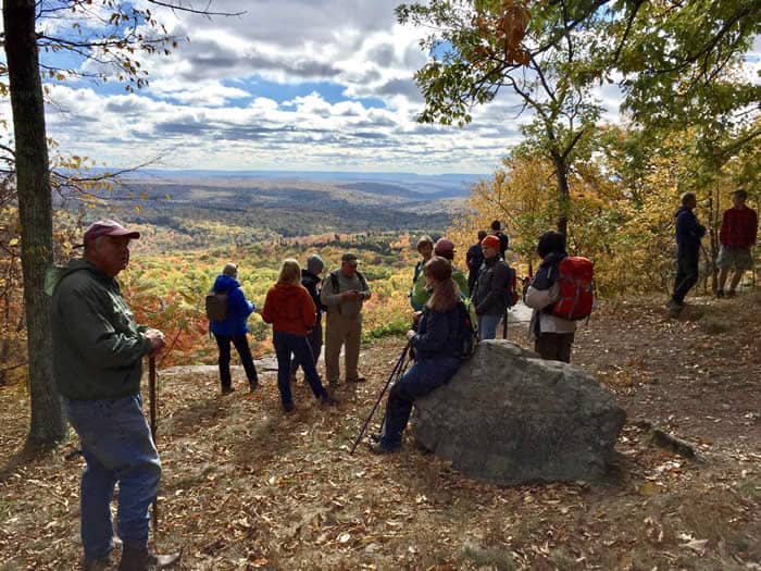
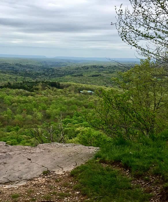
Now this is a view.
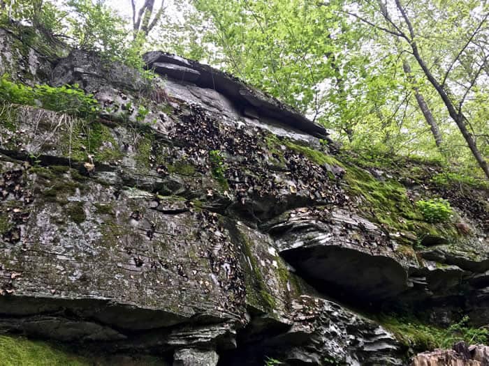
Just about the whole watershed of Brodhead Creek is spread out far and wide below the red rock ledge where I stand. Delaware Water Gap – the destination of every drop of water in every creek in the watershed – is in the distance. Skytop’s West Mountain curves in from the left.
Even on a morning of pale, watery sunlight and rippled grey clouds, it’s an awesome, humbling sight.
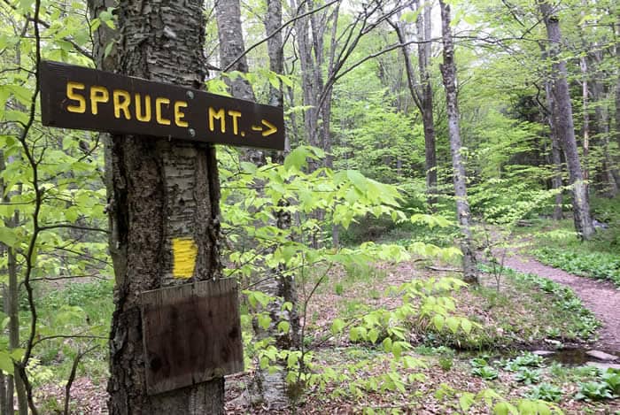
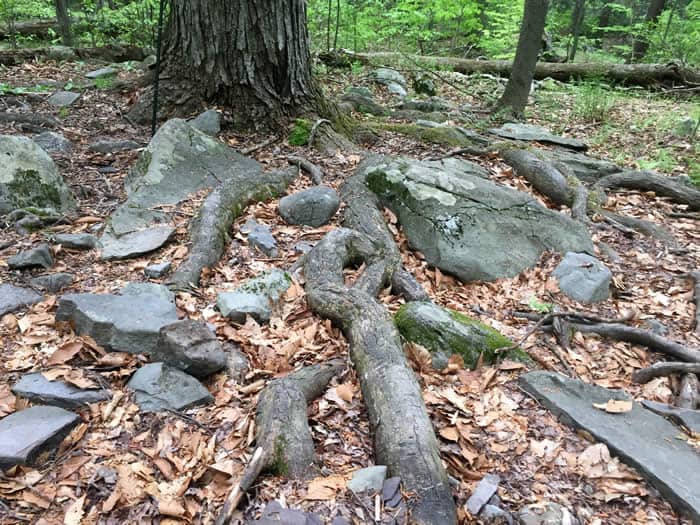
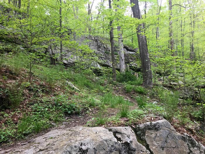
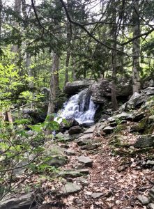 Spruce Mountain is one of the highest points in the watershed, on a level with Mount Wismer, the Knob in Mount Pocono, and Camelback. The trail to the summit takes you past — and through — waterfalls and a fast-flowing creek, around enormous glacier-dropped boulders, and over rocky terrain strewn with shale and twisted with surface-running roots of trees.
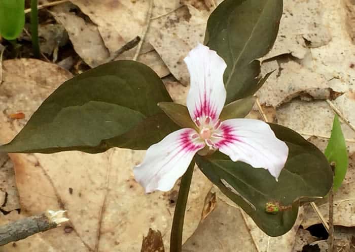
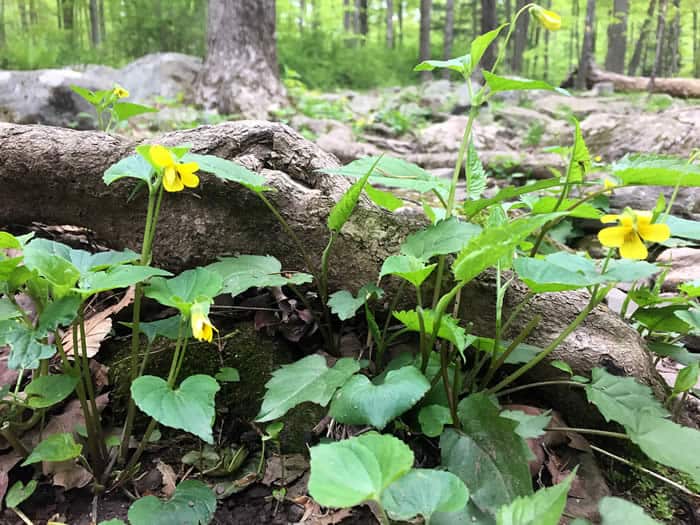
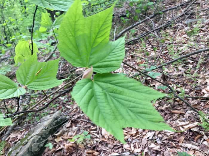
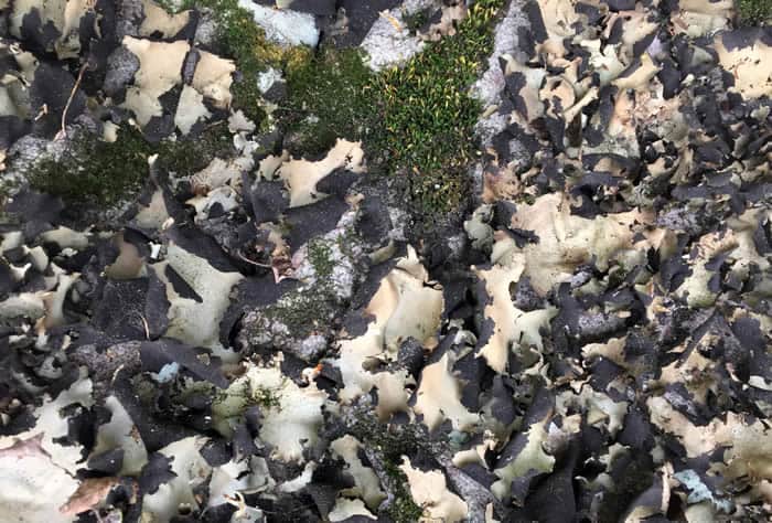
On this early spring morning, I’ve seen dozens of wildflowers and native plants. Jack-in-the-pulpit, red trillium, painted trillium, star flowers and many kinds of violet in shades of yellow, white and purple winked from the leaf litter along the trail. Abundant growths of rock tripe, one of my favorite lichens, flourished on steep rock faces. The fresh new leaves of the mixed hardwood forest cast a greenish glow in the cool, moist air.
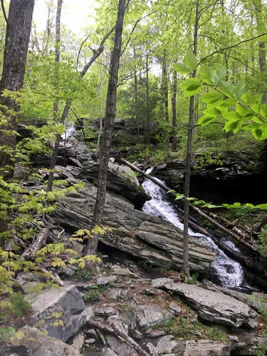
I started out an hour ago at the office of Spruce Lake Retreat in Barrett Township. The land, trails, and facilities here are privately owned, but the public is welcome to enjoy them by paying a small fee. From the office, the trail leads past neat cottages to a picturesque waterfall on Spruce Mountain Run, then along the bank of the run, and quickly leaves the camp behind.
After half an hour of steep climbing, more falling water comes into view. The trail seems to lead directly into the highest waterfall, and in fact it does. Skirting exposed rock and wondering where the next yellow blaze was, I suddenly realized it was above me. The next few yards were wet, slippery and vertical, and my hiking pole was put to good use.
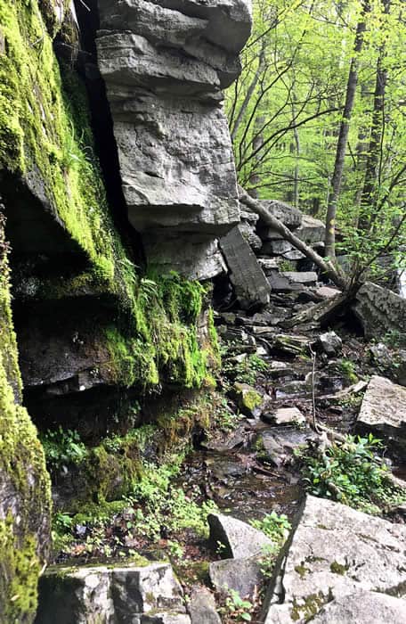
Stopping for breath, I watched the water cascade over the rock, and thought about where it was going. Rising in the marshy wetlands — the “sponge” — of the Pocono Plateau, from here Spruce Mountain Run tumbles more than 400 feet to Middle Branch Creek. The Middle Branch runs along Route 447 toward Canadensis, joining with other tributaries to form Brodhead Creek. Like the water that mesmerizes me here, every creek, run, and stream in the watershed flows from marshland on the Pocono Plateau on its way to the Brodhead, the Delaware River and the Atlantic Ocean.
I still had a steep climb to the view ahead of me, not to mention the return trip back to civilization. Yet it was hard to leave this spot. Water, woods, earth, all the living things surrounding me, the pleasure of breathing it in, the awareness of ancient, primeval rock under my feet — the wonder of it feeds the spirit. How grateful we all can be that these natural resources – both our heritage and our legacy – are part of daily living in the Poconos!
Carol Hillestad is a hike leader and writer for Get Outdoors Poconos, a grant-funded series administered by Brodhead Watershed Association.