
 Cherry Creek
headwaters
Where: Within Cherry Valley National Wildlife Refuge, Stroud Township, Pa. Take Route 33 to the Saylorsburg exit. Go south on Route 115, then left on Lower Cherry Valley Road. Just under Route 33 and before the winery, go right to the trailhead.
GPS coordinates: 40.884063, -75.308476
Trail information: Challenging hike of about 2 miles. Trails are steep and often rocky. Along the creek, trails may be wet. Wear sturdy boots, take water and a map.
![]()
![]()
KNOW BEFORE YOU GO
• With support from many individuals and organizations, including Brodhead Watershed Association and The Nature Conservancy, Friends of Cherry Valley worked with the U.S. Fish and Wildlife Service’s National Wildlife Refuge System in creating Cherry Valley National Wildlife Refuge to conserve and preserve this scenic and unique place. The Friends are dedicated to conserving and enhancing the natural and cultural resources, rural character and scenic beauty of Cherry Valley. Anne Fetherman, Bud Cook and Ed Cramer were among the early supporters of the plan. To learn more, visit Friends of Cherry Valley on Facebook.
• Map and brochure available at the trailhead kiosk.
• No facilities, including trash cans. Pack out whatever you pack in.
• No ATVs or other motorized vehicles. The refuge is patrolled.
• In addition to the Headwaters Tract, hiking is permitted at the former golf course on Croasdale Road.
• For information about hunting in the refuge, click here.
CHERRY VALLEY NATIONAL WILDLIFE REFUGE HIKES:
• A moderate hike on "golf course" loop.
• A difficult hike on Cherry Valley Ridge Trail.
• Update on progress at the refuge.
• Turtle habitat in Cherry Valley.
Walk where a community’s idea changed things for good
By Carol Hillestad
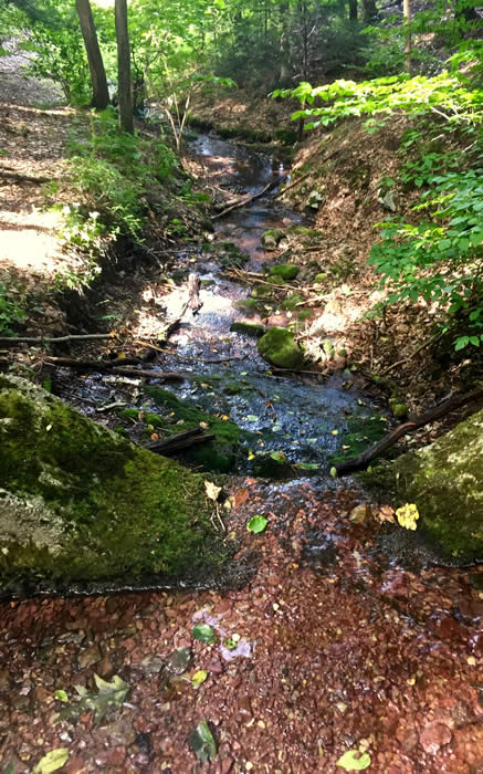
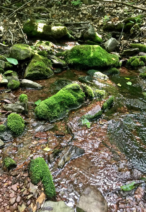
Folded deep in a wooded, steep-sided hollow, a bubbling seep of water flows over mossy rocks and stones. After a dry summer, it is hardly enough to wet my boots. But the place is so still, so other-worldly, that it opens a door in my mind to a time 10,800 years ago.
 This place was a cold, treeless tundra, with low-growing lichens, grasses, dwarf shrubs, and mosses. People who made stone tools left their mark here, as the last glacier receded. Life was hard. Those paleo humans wore animal skins, hunted caribou and sometimes mastodon. Sometimes saber-toothed tigers hunted them.
With a shake of the head, I’m back in the present. Standing at the mossy headwaters of Cherry Creek with me on this sunny fall day are three distinctly modern humans — members of the Friends of Cherry Valley.
Deb Schuler, Carolyn Lange and Jim Vogt have an abiding connection with this place. Indeed, Deb was one of the first members who embarked on the mission protect it.
“It started with an idea,” Deb said. “For generations, farmers and other landowners had safeguarded the clean waters and unique natural habitats of Cherry Valley. But things were changing.” Habitat was being broken up. Pesticides, fertilizers and other chemicals were damaging land and water, birds and mammals, fish, reptiles and amphibians.
Local residents, conservationists and conservation groups united to protect the valley’s history, agricultural heritage and natural resources. Brodhead Watershed Association received a grant to develop a River Conservation Plan for Cherry Valley. The Friends of Cherry Valley was born. The idea of a national wildlife refuge here took root.
The process took years — and an act of Congress. In December 2008, Cherry Valley National Wildlife Refuge was approved. Since then, the U.S. Fish and Wildlife Service has managed, monitored and protected this home of 80 threatened and endangered species.
As we walk the woods trails, Deb, Carolyn and Jim move aside fallen logs, take note of places where blazes are needed, and talk about the future.
“The boundaries of the refuge include 20,466 acres,” Deb says. “That means that within this area, the service may work with willing sellers to purchase habitat-rich lands or conservation easements.” A recent transfer of land brings the total to more than 6,000 acres under protection, a safe haven for birds, reptiles, amphibians and mammals large and small.
As we head downhill toward the trailhead, the creek widens. It was once dammed here to provide water for steam engines, back when Route 33 was a railroad. Now the reservoir has filled in, and water cascades freely toward the valley floor.
From there it meanders through Cherry Valley, under Route 611 and Route 80 in Delaware Water Gap to join the Delaware River. Protected now along much of its length, the water is clean and healthy and supports many kinds of aquatic life — on its way to becoming drinking water for millions.
For a little peace and perspective on modern life, you can go a long way and never find anywhere more refreshing than this idyllic spot, brought to you by a community whose idea changed things for good.
Carol Hillestad is a hike leader and writer for Get Outdoors Poconos, a grant-funded series administered by Brodhead Watershed Association.
Photos and video by Carol Hillestad
 |
|
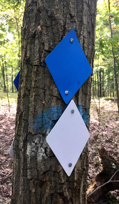
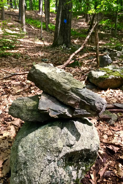
| The trail is clearly marked with blue and white blazes. |
 |
||
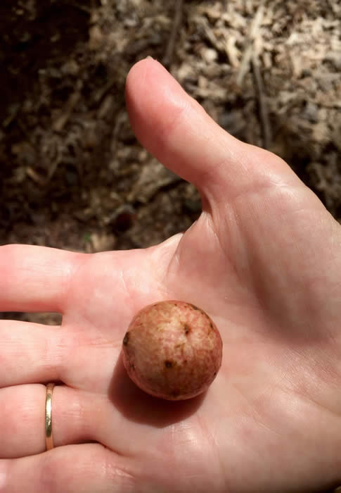
| Carolyn Lange, vice president of Friends of Cherry Valley, holds an oak apple gall, the nursery for a tiny wasp. |
 |
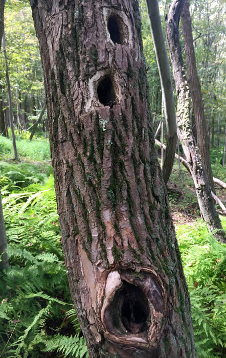 |
| Other hikers have left their mark. | The work of woodpeckers is evidence that standing deadwood has its purpose! |
 |
|
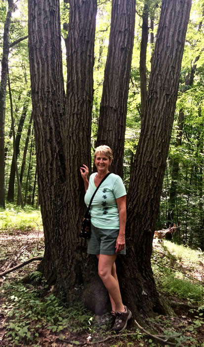
| Deb Schuler is president of Friends of Cherry Valley. This oak is one of her favorites. | |
Comments from other hikers:
Be the first to comment!
Share your experiences of this trail -- what you saw, how you liked it: