
Cherry Valley National Wildlife Refuge update
IF YOU GO
Where: Cherry Valley National Wildlife Refuge is off Cherry Valley Road south of Stroudsburg, Pa. Take Route 191 south past the Stroudsmoor resort. At the bottom of the hill, go left on Cherry Valley Road. At Croasdale Road, go right to parking for the refuge.
GPS coordinates: 40.9710 -75.1714
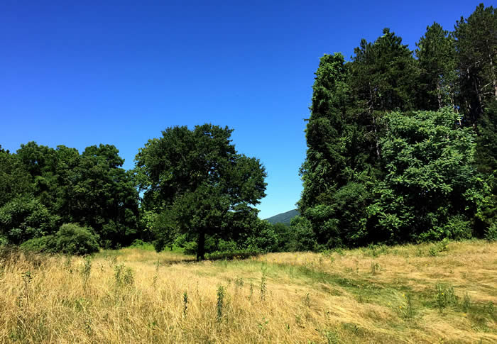
Trail information: A former golf course, the 193-acre preserve has kept the former cart-paths to form two walking loops — the Front Nine and the Back Nine – making for good footing and easy (though hilly) walking. Varied terrain, lots of views, and several miles of hiking options. Trails are hard gravel and well-groomed, with switchbacks, hills, and a gazebo at the highest point. Maps in the kiosk near the parking area.
![]()
![]()
KNOW BEFORE YOU GO:
• Open dawn to dusk.
• No fishing, ATVs or other motorized vehicles. Hunting permitted in certain areas of the refuge. Check here.
• Dogs and bikes not permitted.
• No sanitary facilities or trash receptacles. Please pack out whatever you pack in.
Steps on the path from golf course to nature preserve
By Carol Hillestad
Last time I walked the cart paths at the former Cherry Valley golf course, in 2017, the land had recently become part of the Cherry Valley National Wildlife Refuge. Fairways and greens were being allowed to revert to nature, no longer hyper-fertilized, mowed or manicured. Cherry Creek was flat and slow-moving, but work was underway to return it to its natural, healthy state. There was talk of rebuilding bridges over the creek. All very heartening — but wouldn’t it take, oh, a decade or so to see real progress?
What a difference a year makes.
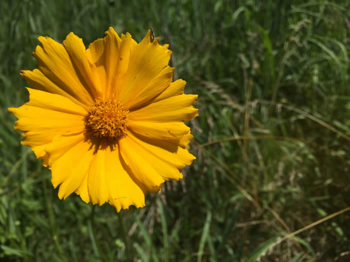
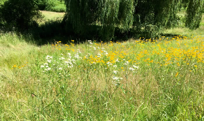
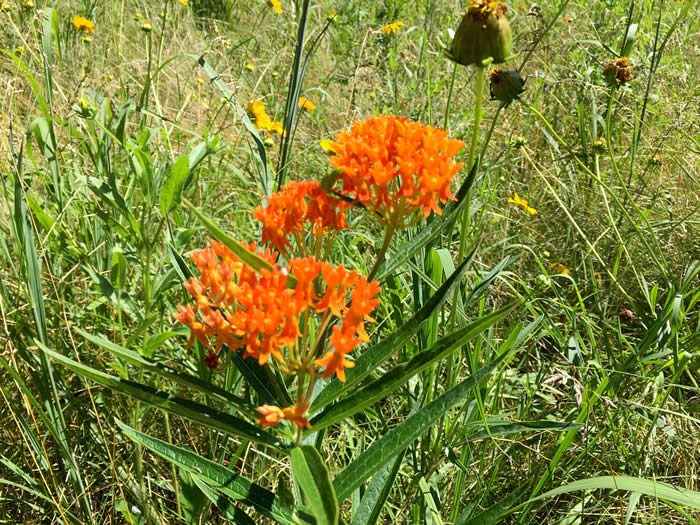
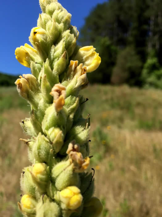
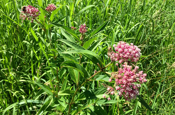
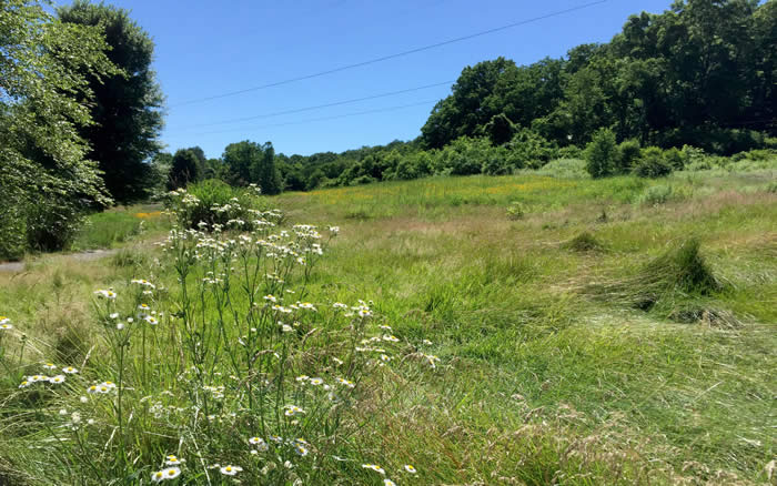
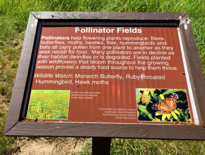
 On a hot, still afternoon this July, the true beauty of this place was unfolding like a new butterfly. The rolling hills are now paradise for pollinators. Queen Anne’s lace, yellow tickseed, daisies and black-eyed Susans, milkweed, Joe Pye weed and 6-foot candelabra of mullein fill the open areas, along with shoulder-high stands of big bluestem grass and russet patches of little bluestem. Monarch, red admiral and painted lady butterflies, bees, bugs, and flying creatures of all kinds danced among the flowers.
Along the cart paths, hickory, black cherry, sycamores, tulip poplars and evergreens create welcome shade. A small wetland, lots of shrubs, grapevines, thistle and willows offer food and cover for birds — red-winged black birds, swifts, gold finches and catbirds, among many others.
At intervals are interpretive signs. These suggest plants or animals to look for, describe how a power line cut can be beneficial in a natural landscape, and explain why good water quality is important, and other items of interest.
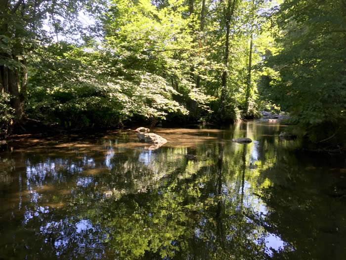
And the creek!
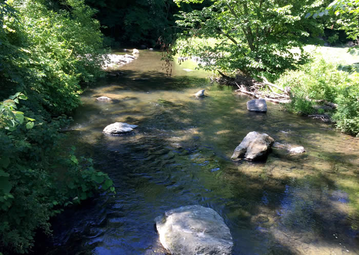
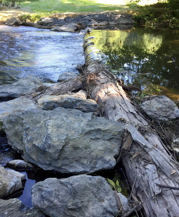
Trout Unlimited volunteers have set groups of big boulders and logs in the creek. These create waterfalls that carve out deeper pools. Downstream from the pools, riffles have formed — fast-moving, turbulent water that tumbles over the rocky stream bed. The pools give trout cool, deep places to hang out. The riffles provide perfect habitat for mayflies, caddisflies, and stoneflies — a smorgasbord for the fish. Two bridges have already been rebuilt.
Science stations along Cherry Creek are managed by the East Stroudsburg University Environmental Club, with supervision from Professor Paul Wilson. Students in all majors on campus take part in the club, monitoring water quality, temperatures, and other factors in stream health.
The creek looks healthier. No longer mowed right up to the edge of the banks, the water is shadier and dappled with sunlight. Its musical bubbling is delicious to hear. Whether it actually is healthier Dr. Wilson and his students are finding out.
Cherry Creek rises from a hillside spring not far from Route 33 near Saylorsburg. As it runs through farmland and behind homes, it picks up runoff, fertilizer, and other contaminants. Approaching the wildlife refuge, it courses through privately preserved land whose owners are conservation-minded and care for the creek. From here, the waters of Cherry Creek eventually flow through Delaware Water Gap and under Route 80 to join Brodhead Creek, the Delaware River, and the Atlantic Ocean.
Back at the trailhead, I wonder what I’ll find here next year. What changes in myself and the world? I’m counting on the changes here being all for the good.
Carol Hillestad is a hike leader and writer for Get Outdoors Poconos, a grant-funded series administered by Brodhead Watershed Association.
 |
||
| One of the rebuilt bridges over Cherry Creek. |
 |
 |
|
| Boulders placed by the Brodhead Chapter of Trout Unlimited help improve aquatic habitat. | Logs and boulders help create cool, deep pools where trout linger. |
 |
|
| Native grasses and wildflowers abound. |
 |
 |
|
| Several kinds of milkweed flourish at the refuge. | Dozens of yellow flowers on common mullein open a few at a time. |
 |
|
| Birds, bees, flies, ants and butterflies are among the pollinators in the fields. |
 |
||
| Manicured fairways are returning to their natural state. |
 |
||
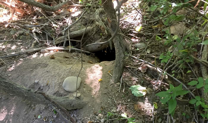
| A groundhog has made herself at home along an old cartpath. |
 |
||
| Interpretive signs are set at intervals along the path. |
Comments from other hikers:
Ernie & Barbara: The hike today through the former golf course in Cherry Valley was delightful (very hot, but delightful nevertheless). Thank you for all you do for those of us who love to hike in these beautiful Poconos, and also for all you and your group do to help keep the environment healthy.
Share your experiences of this trail -- what you saw, how you liked it: