
Making connections:
Trailblazers in Monroe County
 By Carol Hillestad
Miles and miles of walking, hiking, and biking trails crisscross public land throughout Monroe County.
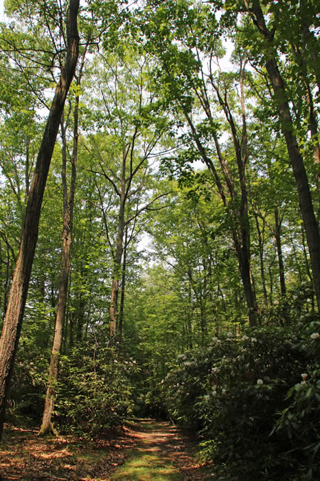
Our trails lead to creeks, ravines and waterfalls, long mountain views, and world-class fishing spots on pristine waters. Keep your eyes peeled and you may see eagles, evidence of possums, raccoons or turkeys. You’ll pass ancient evergreens, fields of blueberries, wetlands teeming with life, and red rock pine barrens.
The time you spend in the natural world can take you on an inner journey, too — from stressed, anxious, or worried to a place of calm, even contentment.
But with trails scattered throughout the county, many would-be walkers don’t know where to start.
What if existing trails could be linked, with access and parking at clearly marked trailheads in every township? More — what if our trail system could be linked to networks of trails beyond? What if you could bike, say, from Delaware Water Gap to the Portland footbridge — even all the way to the Statue of Liberty?
That’s not a pipe dream.
“Most of the Liberty to Water Gap trail already exists, and the Pennsylvania Extension is well on its way,” says Fallon Horan, community planner for Monroe County Planning Commission. “The trails also align with the September 11 National Memorial Trail and create the link from the Statue of Liberty to the Tower of Voices Flight 93 National Memorial in Shenksville and the Pentagon.”
Horan is pulling together decades of trail plans and maps, updating them, and identifying opportunities for connections. A big focus is signage and parking for trails on public land. “Most people live near several community trails,” she says. “We want it to be easy for them to find these amazing properties.”
The ultimate goal of her work is mapping a county-wide system of public trails — and working with townships, land trusts, individuals, and nonprofits to pinpoint gaps and ways to work around them.
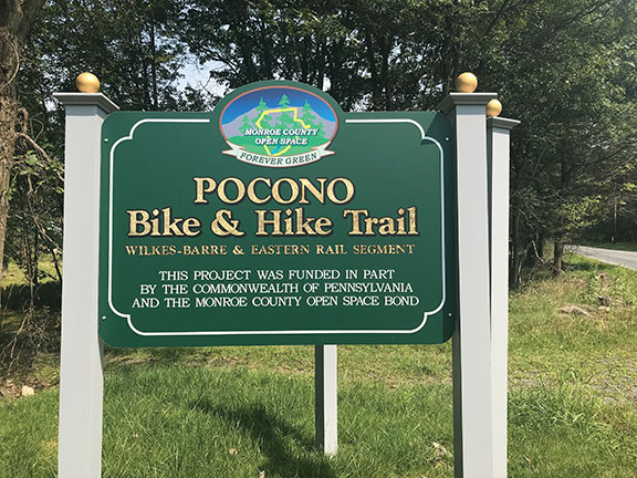
One piece of the puzzle is falling into place in Tobyhanna Township. Julia Heilakka, Tobyhanna’s community engagement coordinator, says, “When the project is completed, we’ll have 28 miles of walking and biking for locals and visitors — a trail from one end of the township to the other.”
A bike lane will connect an old Wilkes Barre & Eastern railroad bed and the western boundary of Pocono Mountain West High School to the Austin T. Blakeslee Natural Area — with its glorious 130 acres of woodland. Situated along Tobyhanna Creek, it’s a popular spot for picnicking, fishing and waterfall-watching.
Autumn Canfield, the township’s assistant manager, says the project will encourage walking and biking for health — and for getting around without getting in a car. Grantmakers like the idea: “Funding is in place for the bike trail, paralleling Route 940. Grants are ready for trailheads and signage, too,” she says.
According to Horan, other townships and boroughs have similar plans. “Interest in trails is booming not just here, but everywhere in the region. Trails create opportunities for businesses and outfitters, as well,” she says.
Brodhead Watershed Association is studying potential ways to link existing trails in the watershed — with the ultimate goal of connecting major natural areas and waterways to each other.
As Heilakka and Canfield say, “Trails make our area a better place to live. Why not make that happen?”
Hmmm. Why not, indeed?
Carol Hillestad is a hike leader and writer for Get Outdoors Poconos, a grant-funded series administered by Brodhead Watershed Association.
MORE ABOUT TRAILS:
• Find maps for dozens of local trails in the Get Outdoors Poconos series.
• For an interactive map of public parks and trails in Monroe County, see monroegis.org/parklocator/
• For a conceptual map of Tobyhanna Township’s Pocono Bike and Hike Trail, click here.
• Info on historical markers planned by Historical Association of Tobyhanna Township: tobyhannatwphistory.org/markers.html
• Map of the Sept. 11 National Memorial Trail: 911trail.org/trail-map/
• Trail maps and information on Delaware State Forest and state parks: dcnr.pa.gov/Recreation/WhereToGo/Pages/default.aspx
 |
|
| Signage marks an access point to the proposed trail connecting the eastern end of Tobyhanna Township to Austin T. Blakeslee Preserve. |
 |
|
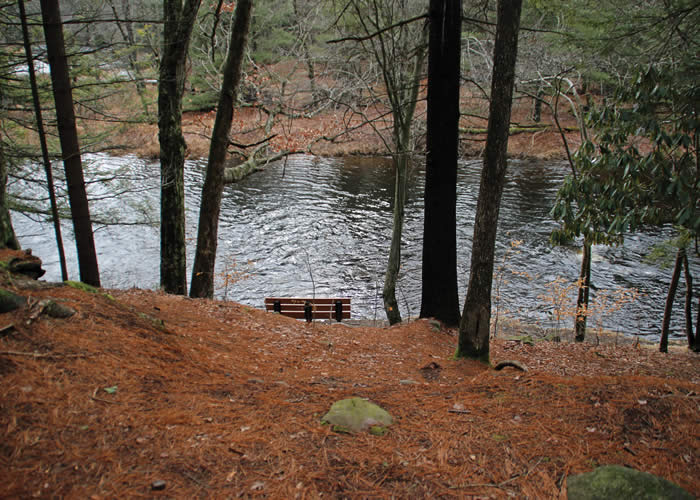
| A destination of the trail system being developed in Tobyhanna Township is the Austin T. Blakeslee natural area, which offers 130 acres of trails, creek and waterfall views, benches and picnic spots. |
Comments from other hikers:
Be the first to comment!
Share your experiences of this trail -- what you saw, how you liked it: