
Spruce Mountain
 IF YOU GO
Where: Spruce Lake Retreat, Barrett Township.
5389 Route 447, Canadensis, Pa.
GPS: 41.227208, -75.267647
Take Route 447 to the stoplight in Canadensis. Continue straight ahead on 447 to Dutch Hill Road. Go right. (This detour is necessary because a bridge is being repaired on 447, as of 2019.) Follow Dutch Hill Road until it takes a hard right turn — instead of taking the turn, continue straight onto Gravel Road. Follow Gravel Road (watch potholes!) to where it ends at 447. The entrance to Spruce Lake Retreat is straight ahead. Follow signs to the office parking area.
Trail information: Trail is 2.5 miles round trip and very difficult — rocky, wet, and steep with about 400 feet elevation change. Some climbing. Boots, hiking stick, and good balance required.
![]()
![]()
KNOW BEFORE YOU GO:
• Spruce Lake Retreat charges a $5 per-person fee for public access to trails. This fee includes access to other resort facilities for the day. Payable at the office.
Hike to the top of the watershed at Spruce Mountain
By Carol Hillestad
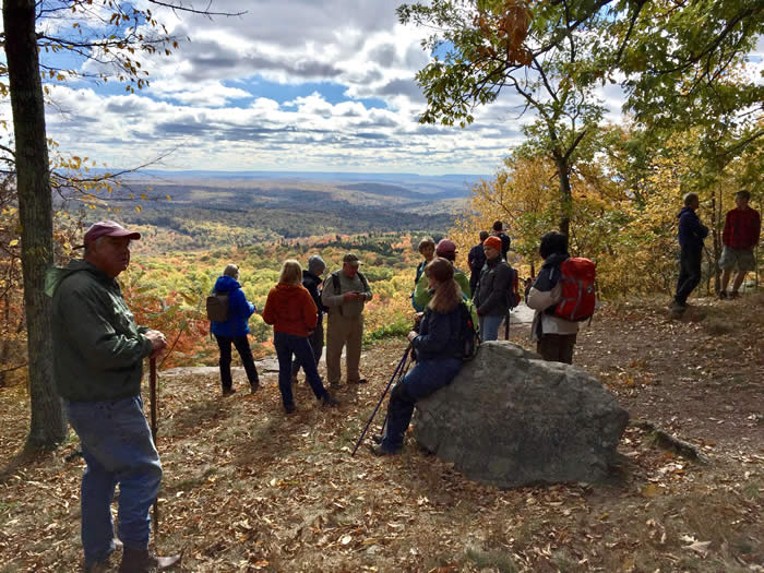
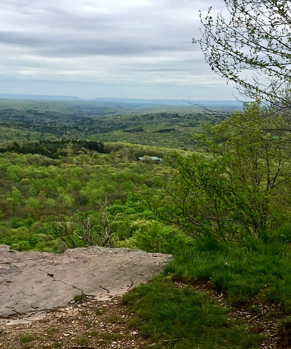
Now this is a view.
Just about the whole watershed of Brodhead Creek is spread out far and wide below the red rock ledge where I stand. Delaware Water Gap – the destination of every drop of water in every creek in the watershed – is in the distance. Skytop’s West Mountain curves in from the left.
Even on a morning of pale, watery sunlight and rippled grey clouds, it’s an awesome, humbling sight.
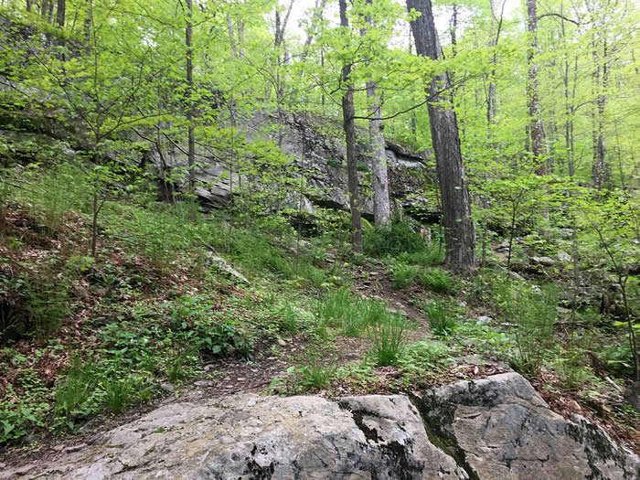
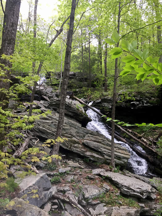
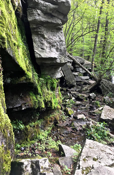
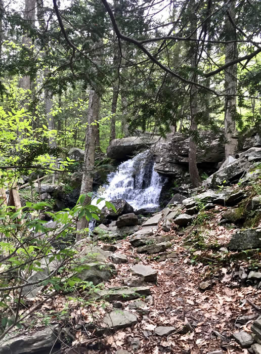 Spruce Mountain is one of the highest points in the watershed, on a level with Mount Wismer, the Knob in Mount Pocono, and Camelback. The trail to the summit takes you past — and through — waterfalls and a fast-flowing creek, around enormous glacier-dropped boulders, and over rocky terrain strewn with shale and twisted with surface-running roots of trees.
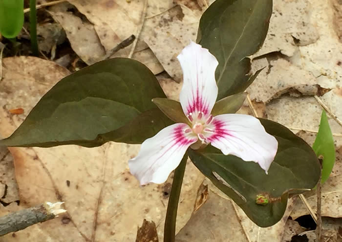
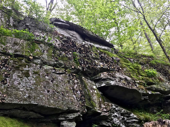
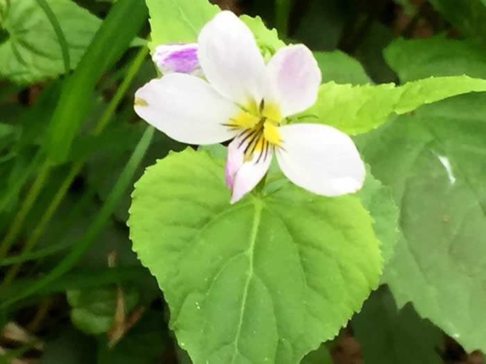
On this early spring morning, I’ve seen dozens of wildflowers and native plants. Jack-in-the-pulpit, red trillium, painted trillium, star flowers and many kinds of violet in shades of yellow, white and purple winked from the leaf litter along the trail. Abundant growths of rock tripe, one of my favorite lichens, flourished on steep rock faces. The fresh new leaves of the mixed hardwood forest cast a greenish glow in the cool, moist air.
I started out an hour ago at the office of Spruce Lake Retreat in Barrett Township. The land, trails, and facilities here are privately owned, but the public is welcome to enjoy them by paying a small fee. From the office, the trail leads past neat cottages to a picturesque waterfall on Spruce Mountain Run, then along the bank of the run, and quickly leaves the camp behind.
After half an hour of steep climbing, more falling water comes into view. The trail seems to lead directly into the highest waterfall, and in fact it does. Skirting exposed rock and wondering where the next yellow blaze was, I suddenly realized it was above me. The next few yards were wet, slippery and vertical, and my hiking pole was put to good use.
Stopping for breath, I watched the water cascade over the rock, and thought about where it was going. Rising in the marshy wetlands — the “sponge” — of the Pocono Plateau, from here Spruce Mountain Run tumbles more than 400 feet to Middle Branch Creek. The Middle Branch runs along Route 447 toward Canadensis, joining with other tributaries to form Brodhead Creek. Like the water that mesmerizes me here, every creek, run, and stream in the watershed flows from marshland on the Pocono Plateau on its way to the Brodhead, the Delaware River and the Atlantic Ocean.
I still had a steep climb to the view ahead of me, not to mention the return trip back to civilization. Yet it was hard to leave this spot. Water, woods, earth, all the living things surrounding me, the pleasure of breathing it in, the awareness of ancient, primeval rock under my feet — the wonder of it feeds the spirit. How grateful we all can be that these natural resources – both our heritage and our legacy – are part of daily living in the Poconos!
Carol Hillestad is a hike leader and writer for Get Outdoors Poconos, a grant-funded series administered by Brodhead Watershed Association.
Photos by Carol Hillestad
 |
|
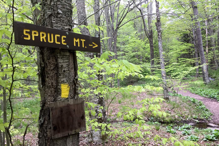
| The trail begins. Yellow blazes show the way. |
 |
||
Lichens, mosses, ferns and herbaceous plants find a foothold in the bare rock. |
 |
||
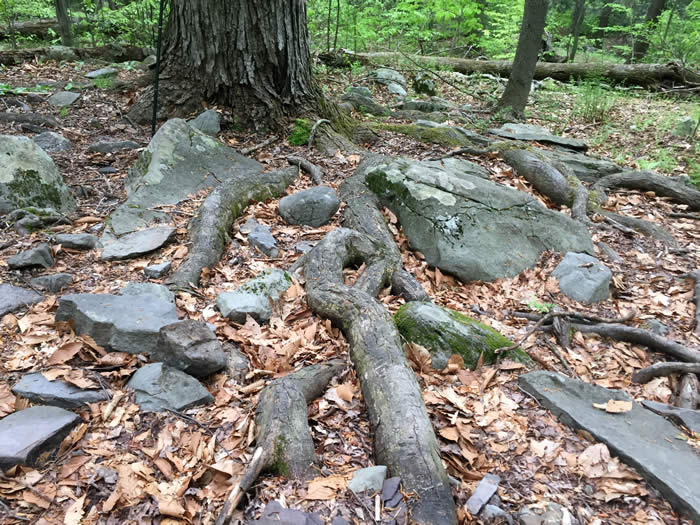
Tree roots and rocks require careful walking. |
 |
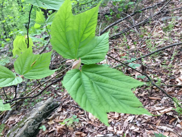 |
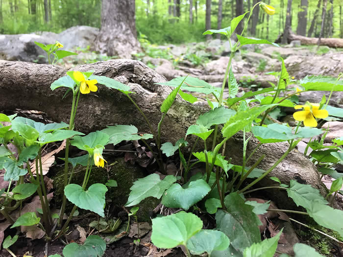
| Yellow violets. | Goosefoot or striped maple is a shrubby north-woods understory tree that grows at higher elevations in the Poconos. |
 |
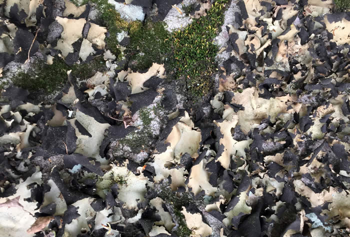 |
| At 8 to 12 inches high, Canadian violet is much taller than other natives. | Rock tripe, considered a “famine food” today, may have been a staple for the original people living in our region. Like other lichens, it can also be used as a dye. |
 |
|
| The trail rises steeply through mixed hardwood forest. |
 |
 |
| A rugged climb brings more falling water into view. | Um, yes, this IS the trail… |
 |
|
| From the top of the watershed, looking toward Delaware Water Gap, the ultimate destination of all the water in the Brodhead Watershed. |
Comments from other hikers:
Be the first to comment!
Share your experiences of this trail -- what you saw, how you liked it: