
Visiting a dry dam
Editor's note: The dry dam is owned, managed and maintained by Monroe County, and is not open to the public. This article describes how dry dams work and how important they are to the watershed and the safety of residents.
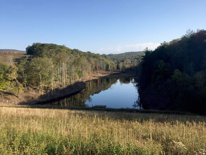
After a summer with double the normal rainfall, the dry dam shows how it works — water from the tiny Leavitt Branch of Brodhead Creek is held back from rushing downstream, thus avoiding erosion and property damage.
Nature has a way with water
By Carol Hillestad
A dry dam sounds like a contradiction. The point of a dam is to hold water, right?
The answer, I’m learning, is yes. And also no.
In August of 1955, a catastrophic flood in the Poconos swept away homes and lives. It destroyed dozens of bridges, ravaged businesses, and left the Brodhead Creek watershed — and most of Monroe County — in tatters.
In the aftermath, rebuilding was not enough. Everyone wanted to protect against future devastation. Dry dams were part of the solution.
After hearing about these structures for 30 years, on a recent blue-and-white October morning I finally got to see one. It stretches from one side to the other of the narrow, steep-sided valley where flows the Leavitt Branch, one of the headwaters of Brodhead Creek. The dam is almost 10 stories high, and the trail across the top runs perhaps a quarter mile from end to end. It dwarfs the Leavitt Branch waters, far below.
Yet on the upstream side of the dam, drainage from this summer’s record-breaking rains has collected as a small lake. The dam kept this water from racing away downstream, and its outlet structures release the runoff water at a controlled rate. The lake will slowly shrink, and the dam will become dry again. With a capacity of 350,000,000 gallons, after major storm events, the dam could save lives.
It took vision — and political will — to build this dam and a similar one that controls Goose Pond Run, another headwaters creek of the Brodhead. It also took almost 20 years, but Monroe County commissioners and the county Conservation District persevered. With help from the Soil Conservation Service of the U.S. Department of Agriculture, the dam was dedicated in 1974. Every person and property downstream is safer for it.
But nature is all connected, and humans tinker with it at their peril. Creeks naturally meander over time in their flood plains. Floods are natural. Water goes where it must go. Every time we build anything in a flood plain or on a stream — including a dry dam — we’re committing to maintaining it, basically forever, against nature.
I’m looking forward to learning more. Adam Schellhammer, district manager at the Monroe County Conservation District, will share the story and the science: how to protect drinking water, prevent erosion, keep the watershed safe, and coexist with nature, rather than constantly fighting it. His talk will be indoors, and we’ll carpool to see the dam.
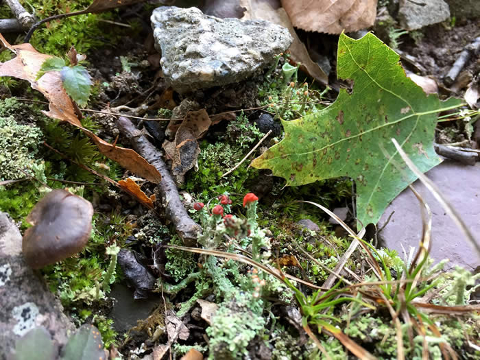
The walk at the dam is short, but there is plenty to see. Many kinds of lichen are here, such as pixie cup and British soldiers lichens. Under the chestnut oaks and pin oaks rests a heavy crop of acorns. Witch hazel is in bloom, along with fall asters and goldenrod. Milkweed releases its seeds on silken parachutes, and the silhouette of Camelback is clear in the distance.
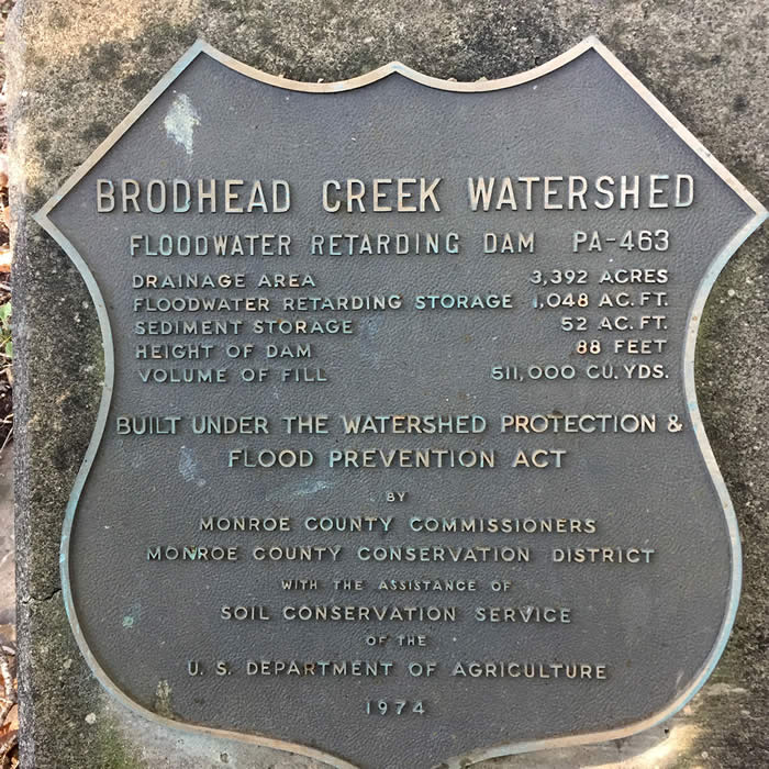
Headed back to the car, I notice a chunk of concrete set into the ground on the uphill side of the path. Somehow I’d missed this handsome marker. “Brodhead Creek Watershed Floodwater Retarding Dam,” it read, along with the height of the dam, the volume of fill used to build it, the flood of water it was meant to contain.
Plenty to see here. And plenty to think about, too.
NOTE: The USDA’s Soil Conservation Service is now known as the Natural Resources Conservation Service. Monroe County Conservation District was formed in the 1940s to keep soil on the land and to protect our drinking water.
Carol Hillestad is a hike leader and writer for Get Outdoors Poconos, a grant-funded series administered by Brodhead Watershed Association. Special thanks to Patti O’Keefe for guiding Carol to the dry dam.
Photos by Carol Hillestad
 |
|
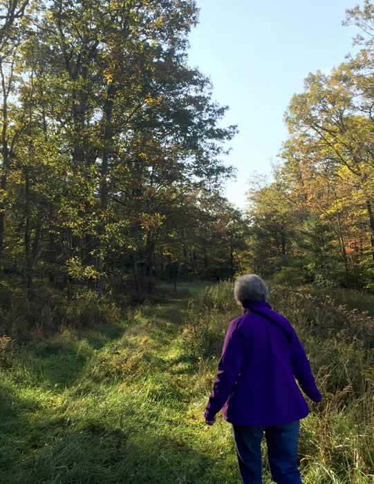
| The trail from the parking area to the dam is wide and grassy, and very short — about half a mile round trip. |
 |
|
This marker, set in a concrete pier, offers lots of information about the dry dam and its capacity. 1,048 acre feet equals about 350 million gallons of water. |
|
 |
|
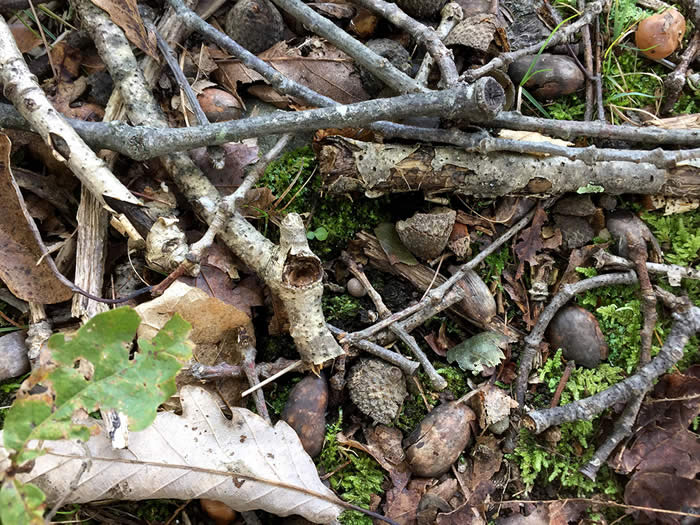
| One of nature’s still-lifes of acorns, twigs, fallen leaves and moss near the dry dam. |
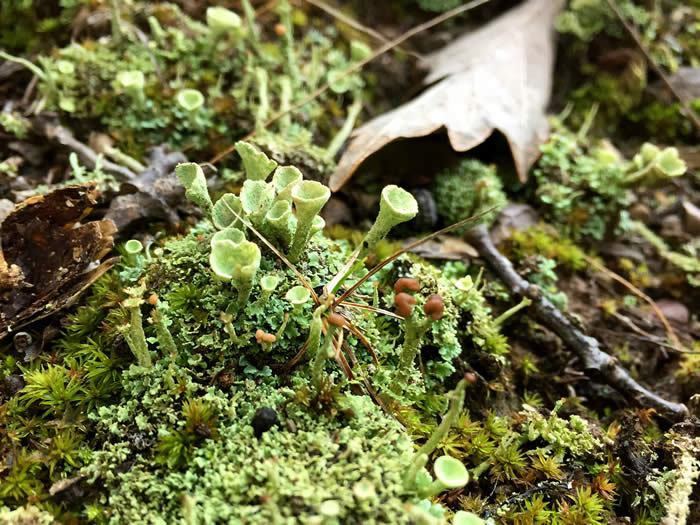 |
| “Pixie cup” lichen are among the tiny wonders at ground level near the dry dam. |
 |
|
| These lichen are called “British soldiers” for the bright red of their fruiting body. |
Comments from other visitors:
Be the first to comment!
Share your experiences of this property -- what you saw, how you liked it: